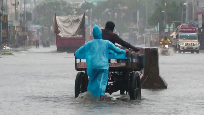
Chennai and surrounding districts face an Orange Alert as the weakened but stationary remnant of Cyclone Ditwah—just 35 km offshore—continues to dump extreme rain (Ennore recorded 26 cm). The system is expected to weaken by midnight, but heavy spells, waterlogging, and Deputy CM Stalin’s site visits mean the crisis mode isn’t ending yet.
The thing that keeps hitting Chennai is that this system, the remnant of Cyclone Ditwah, it just won’t move.
It’s been practically stationary. Hovering right there, just 35 km off the coast. It’s weakened into a deep depression, sure, but that proximity is feeding continuous, heavy cloud bands right onto North Tamil Nadu. That sluggish movement happened. And then the relentless flooding followed.
IMD has an Orange Alert out for Chennai, Tiruvallur, Kancheepuram, Chengalpattu, and Ranipettai. They’re predicting moderate to intense spells with wind speeds up to 60 kmph in some parts.
The Damage Report is Stark
The rainfall totals are staggering, especially up north. We’re talking extreme numbers:
-
Ennore: 26 cm in the last 24 hours. That’s insane.
-
Parrys: 25 cm.
-
Ice House: 22 cm.
Overnight, the strong winds and the sheer volume of water made tree branches fall everywhere. Roads are heavily inundated. Major arterial roads like Poonamallee Highway are crippled with severe waterlogging. Cars are getting stuck in hidden ditches. Residents are demanding action, let’s be real. It’s a mess.
The Political Response
The State government is in crisis mode, which is what draws people there—the immediate, visible action. Deputy Chief Minister Udhayanidhi Stalin, Minister K.N. Nehru, and Mayor Priya Rajan are out there. They held a review meeting with Corporation officials, then they went to the affected areas. The Mayor even confirmed they’ve put out nearly 2 lakh food packets. That local, on-the-ground presence is necessary.
And here’s the kicker: the weather office says the system is “very likely to recurve slowly southwestwards” and weaken into a well-marked low-pressure area by Tuesday midnight. Very likely.
So, heavy rain is expected to continue relentlessly until then. Then, it might subside. But even after it weakens, the cleanup, the rescue, the recovery—that’s just starting. It’s an ongoing situation that is far from over for the residents dealing with feet of water in their neighborhoods.
End…


